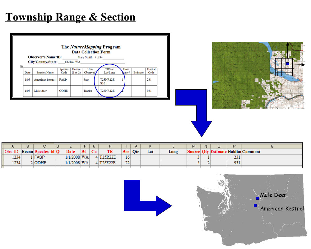
Home | About Us | How to Participate | Biodiversity Modules | Projects | Maps | News | Resources NatureMapping Activities13. Using Emerging Technologies: Steps to collect geographic dataThe steps between filling out the Data Collection form to GIS analyses
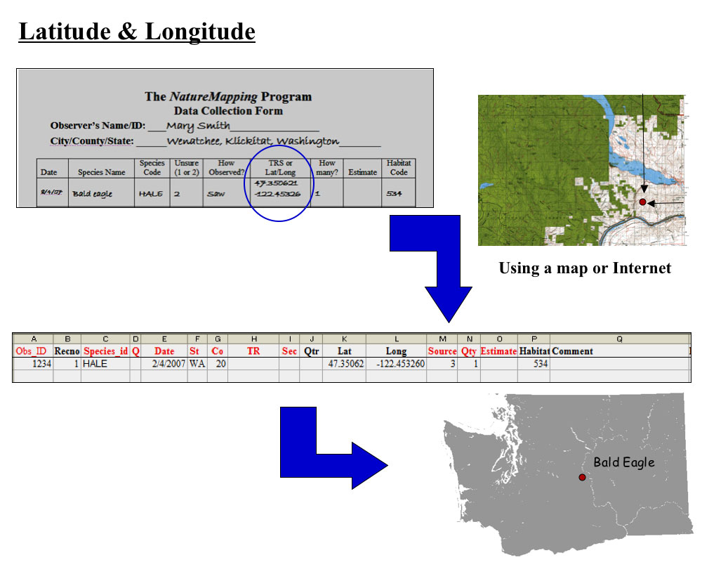
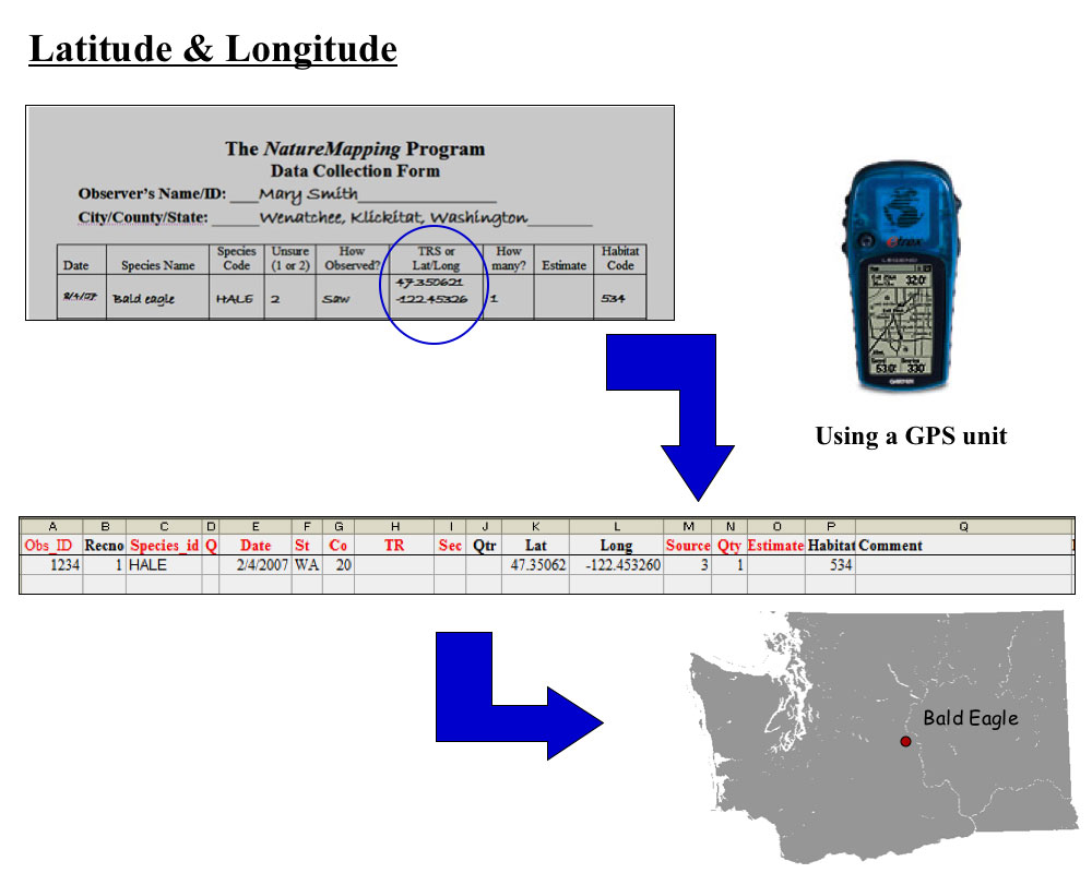
There are 2 ways to record geographic location covered in Activity 8:
There are multiple ways to collect Latitude and Longitude:
|