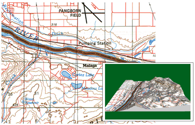
Cultural Features
Black is used for man-made features such as roads, buildings,
names and boundaries.
Red is used with tints for emphasis on classes of roads, to
show urban areas and public land subdivision lines.
Natural Features
Blue is used for hydrographic (e.g. water) features such as lakes,
rivers, canals and glaciers.
Green is used for native vegetation, forests, with pattern variations
for scrub, agricultural vineyards and orchards.
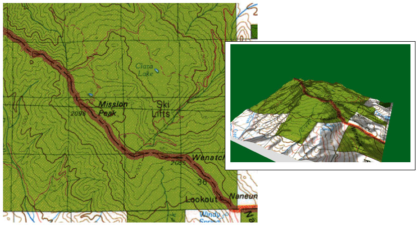
Questions
1. What does the green color mean in the map below?
2. Public lands (e.g., US Forest Service, National Park Service, etc.)
can also be colored green.
Do you think the ski lift is within US Forest Service property?
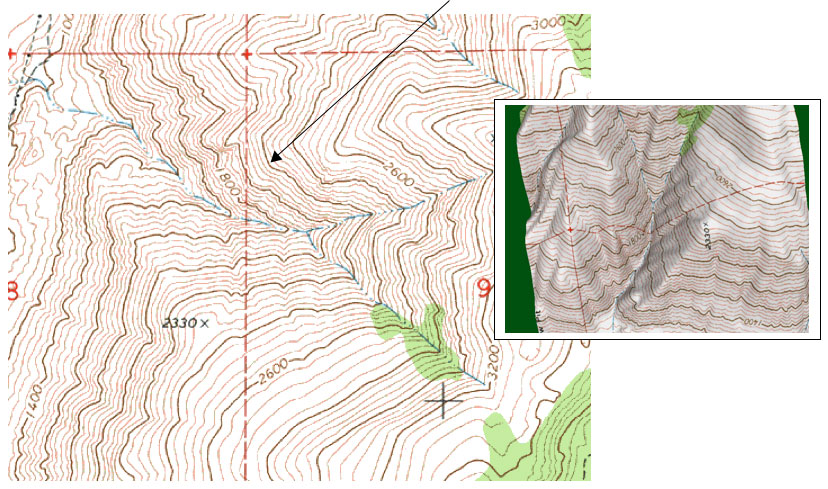
Contours Show Land Shapes and Elevation
Landform, portrayed by contours, is the distinctive characteristic of topographic
maps. Contours are imaginary lines of equal elevations, above sea
level, which define the land surface.
Contour Interval is the regular elevation difference between contour
lines on maps. Small contour intervals are used where terrain is relatively
flat; larger intervals in mountain areas.
Index Contours, every fourth or fifth line, are heavier width lines with
elevations labeled.
Questions
1. If each contour line = 40 feet, then what is the elevation for
this line?
2. How can you tell in the 3D picture which way the streams are flowing
based on the contour lines if the stream is going down, then the contour lines
point ____
Question
1. If the map below is facing north, from which direction are you
looking at the 3D map?