NatureMapping Activities
Student Guide
Latitude and Longitude (Lat/Long)
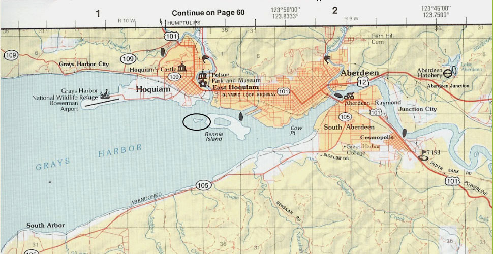
Mapping Practice for Grays Harbor County
Instructions
- View the map below and find the Lat/Long for the circled location.
- Remember:
There are 60 minutes in a Degree
60 seconds in a minute.
- Latitude increases as you go north
- Longitude increases as you go west
- Tick marks along the edge of the map are one minute increments

Question:
What is the Longitude of the circled area?
Click to View Answer
NatureMapping Activities
Home |
About Us |
How to Participate |
Biodiversity Modules |
Projects |
Maps |
News |
Resources
© 2008 NatureMapping
|