
Breeding Range Map
The green area shows the predicted habitats for breeding only.
© NatureMapping Program
+ enlarge map
Predicted breeding range
 = Core Habitat = Core Habitat
 = Marginal Habitat = Marginal Habitat
|
|
Fact Sheet:
Basic |
Advanced
Breeding Range Map
Amphibians do not migrate as some birds and mammals, so the colored areas depict the predicted range for the Great Basin Spadefoot Toad year-round. The habitats were identified using 1991 satellite imagery, other datasets and experts throughout the state, as part of the Washington Gap Analysis Project.

Observations
|
Metadata
(Data about data or how the map was made)
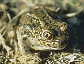
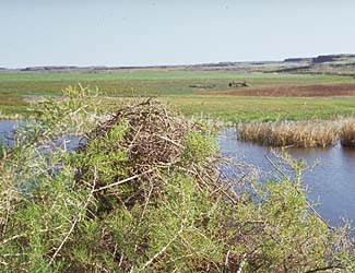
Distribution and Habitat Requirements
This toad occurs in most of the Columbia Basin (Leonard et al., 1993) utilizing
a variety of permanent and temporary waters, such as pothole ponds, irrigation
waters and roadside ditches. This species spends most of its life underground,
preferring sandy habitats. The Great Basin spadefoot toad seems to prefer
pools with bare mud or grasses and forbs, and is not generally found in or
alongside large lakes and rivers or wetlands where fish are present (John
Hall, pers. comm.).
Models
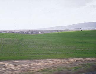
The Columbia Basin, Blue Mountains, and Northeast Corner ecoregions were selected.
All zones within the Columbia Basin region were core. The Ponderosa Pine
zone in the Northwest and Blue Mountains and the Oak zone were marginal.
Rivers and riparian areas were good habitats, but large areas of open water
were excluded. All non-forested, low-density development, irrigated row crops
and orchards and non-irrigated conservation reserve areas were considered suitable
if appropriate microhabitats existed.
Translated from the Washington Gap Analysis Amphibians and Reptiles Volume by Karen Dvornich
Webpage designed by Dave Lester.
|

