
Home | About Us | How to Participate | Biodiversity Modules | Projects | Maps | News | Resources
Home | About Us | How to Participate | Biodiversity Modules | Projects | Maps | News | Resources
Species Code: PSMI
Legend: Breeding Range Map Metadata (Data about data or how the map was made) Click to enlarge distribution map Map with Breeding Bird Atlas records
|
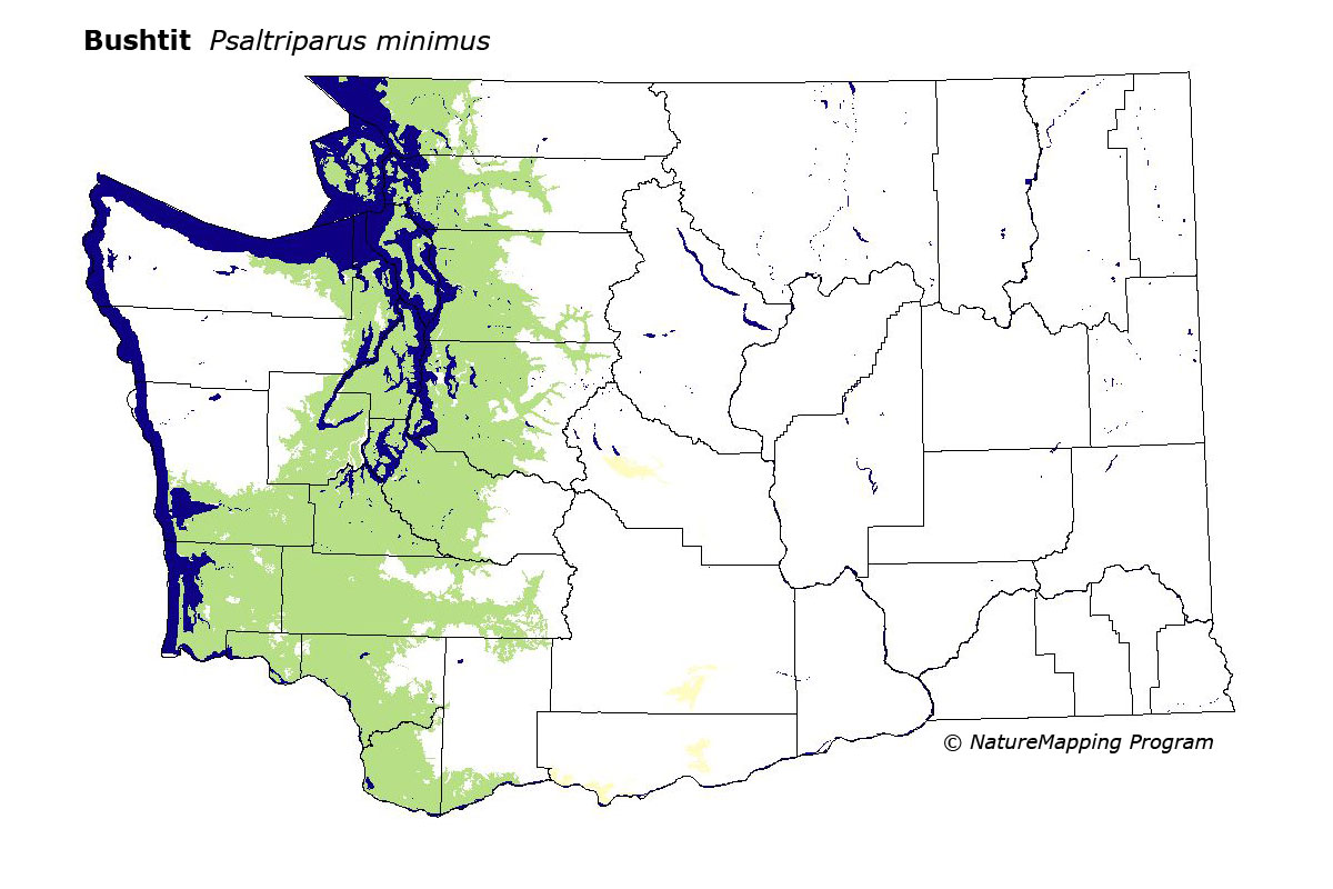
The Bushtit is common in shrubby growth, hardwood, and mixed forests associated with residential area throughout the Puget Trough, west to Ocean Shores, and south to Vancouver. It occurs along the Columbia River at low elevations east to Rock Creek.
On the west side, core zones were all below Silver Fir. Closed canopy early seral conifer forests were adequate. On the east side, it occurred peripherally and locally in scattered locations in low zones in Klickitat, Yakima, and Kittitas Counties, where low-to-mid-density development, irrigated pastures and orchards, wetlands, hardwood forests, and mixed forests were good habitat.
With increased conversion of conifer forests to residential areas, Bushtit habitat has increased greatly in the form of regrowth in cut-over areas and ornamental plantings in residential areas. In eastern Washington, the isolated populations may have been established via emigration from the west across Snoqualmie Pass and other passes in the central and southern Cascades.
Translated from the Washington Gap Analysis Bird Volume by Uchenna Bright
Text edited by Gussie Litwer
Webpage designed by Dave Lester
 = Core Habitat
 = Marginal Habitat