
Home | About Us | How to Participate | Biodiversity Modules | Projects | Maps | News | Resources
Home | About Us | How to Participate | Biodiversity Modules | Projects | Maps | News | Resources
Species Code: TYPH
Legend: Breeding Range Map Metadata (Data about data or how the map was made) Click to enlarge distribution map
|
This species is found in the northern Columbia basin. They are very local and rare with their numbers seriously declining.
Good habitats in the core areas of use were grass and shrub savanna in the Three-tip Sage and Central Arid steppe zones, plus grassy openings in the lowest edges of the Ponderosa Pine zone. Its favored habitats of grasslands have been largely converted to agriculture, leaving very little space for this species. Undoubtedly this Grouse was much more common in the past than it is now. It is likely that this conversion of their favored habitat has caused some of the disturbing declines that have been noted over the past 40 years.
This species is threatened in Washington State and a federal species of concern. It occurs year-around in Alaska and the Yukon, and south to Alberta, east to Quebec, South Dakota, Minnesota and Wisconsin. It is also seen in eastern Washington, Idaho, Utah, Wyoming and Colorado.
Translated from the Washington Gap Analysis Bird Volume by Uchenna Bright
Text edited by Gussie Litwer
Webpage designed by Dave Lester
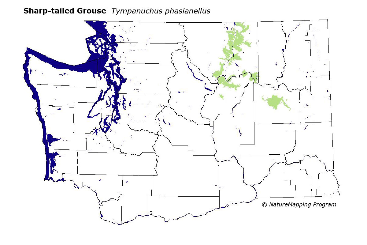
 = Core Habitat
 = Marginal Habitat