Home | About Us | Maps | Animal Facts
GAP Analysis Predicted Distribution Map
Home | About Us | Maps | Animal Facts
Species Code: CASCA
|
Habitat
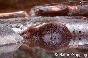
Found along permanent streams, rivers, and lakes with trees or woody shrubs lining banks or in very close proximity. Beavers prefer hardwood trees, especially aspen, cottonwoods, and willow, but also use conifers and can exist where hardwood trees are absent. Most abundant in lowlands but occurs up to about 5000 feet in Washington. May occur in hot desert where suitable conditions exist.
Core zones included all steppe zones and most forested zones below Mountain Hemlock and Sub-alpine Fir. Fresh water/wetlands in all zones are good habitat. The Beaver requires moderately large bodies of water but they do breed in ponds below 100 acres.
Translated from the Washington Gap Analysis Bird Volume by Dave Lester
Design by Tim Knight

 = Core Habitat
 = Marginal Habitat