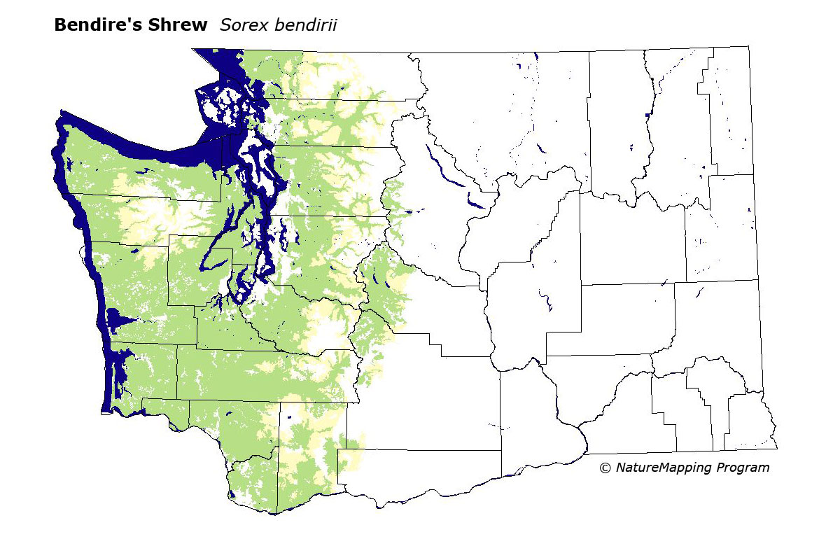
GAP Analysis Predicted Distribution Map
Bendire's Shrew (Sorex bendirii)
Species Code: SOBE
|
Legend:
 = Core Habitat = Core Habitat
 = Marginal Habitat = Marginal Habitat
Breeding Range Map
The green area shows the predicted habitats for breeding only.
The habitats were identified using 1991 satellite imagery, other datasets and
experts throughout the state, as part of the Washington Gap Analysis Project.
Click to enlarge distribution map
Map with historical museum records
|
Metadata
(Data about data or how the map was made)
Bendire's Shrew occurs in marshes, swamps, wet meadows, along (mostly) slow
streams: usually found near water, but up to a mile from it in wet, dense forests.
Mostly found in Humid Transition zone, but commonly up to the lower Canadian
zone and sometimes to the upper Canadian zone.
Core zones were all low and mid-elevation zones west of the Cascade crest
except Lava Flows, which were excluded. Silver Fir was peripheral. East of
the crest, Interior Western Hemlock and Grand Fir were core, and Interior Douglas-fir
and Oak were peripheral.
Fresh water/wetlands were good habitats in all zones. In most of the zones,
closed forest was also good.
Translated from the Washington Gap Analysis Mammal Volume by Dave Lester
Webpage designed by Dave Lester