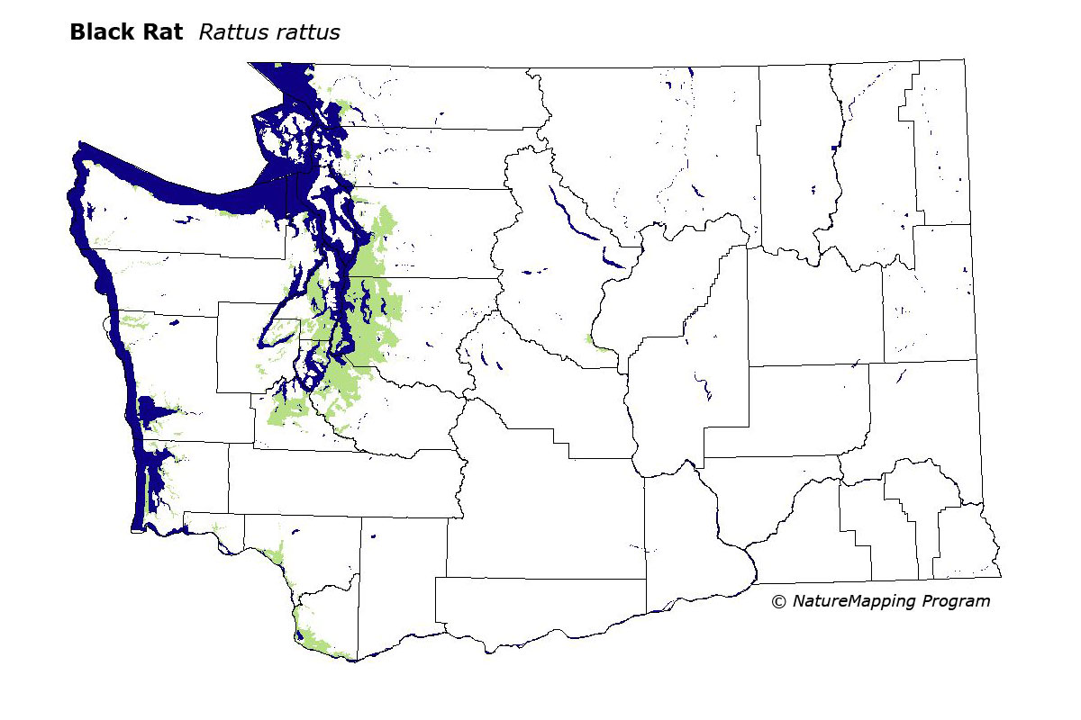
GAP Analysis Predicted Distribution Map
Black Rat (Rattus rattus)
Species Code: RARA
|
Legend:
 = Core Habitat = Core Habitat
 = Marginal Habitat = Marginal Habitat
Breeding Range Map
The green area shows the predicted habitats for breeding only. The habitats were
identified using 1991 satellite imagery, other datasets and experts throughout the state, as part of the Washington Gap Analysis
Project.
Click to enlarge distribution map
Map with historical museum records
|
Metadata
(Data about data or how the map was made)
The Black Rat is primarily associated with human habitation, mostly around
wharves in coastal cities and along bays and coast where there is a zone of
beach grass and tidal debris. It doesn't compete well with the Norwegian Rat.
Range is limited to the coast and Columbia River on the west side and the
Wenatchee area on the east. Core zones were all of the lowest elevation. Good
habitat is developed area in all zones where it is known to occur. On the west
side, low elevation rivers, estuaries, and beaches are good.
Translated from the Washington Gap Analysis Mammal Volume by Dave Lester
Webpage designed by Dave Lester