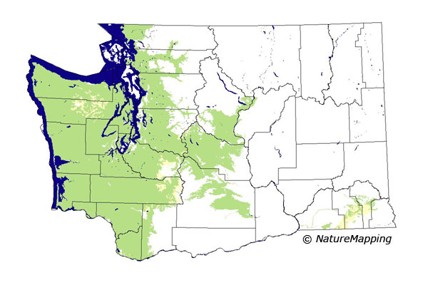
GAP Analysis Predicted Distribution Map
Coast Mole (Scapanus orarius)
Species Code: SCOR
|
Legend:
 = Core Habitat = Core Habitat
 = Marginal Habitat = Marginal Habitat
Breeding Range Map
The green area shows the predicted habitats for breeding only. The habitats were
identified using 1991 satellite imagery, other datasets and experts throughout the state, as part of the Washington Gap Analysis
Project.
Click to enlarge distribution map
Map with historical museum records
|
Metadata
(Data about data or how the map was made)
Occurs in a wide range of habitats from sea level to subalpine forests. In
lowlands, it occurs in pastures, gardens, cultivated fields, irrigated fruit
orchards and grassy meadows, but avoids land subject to flooding. Its range
narrows greatly at the north end of its range. In Whatcom, Skagit, Snohomish
and northern King County, it is probably confined to lowlands along the Sound
and to river bottoms below 1000 feet. On the Olympic Peninsula, it goes up
to about 5000 or 6000 feet.
In all forested zones except Ponderosa Pine, water/wetlands (except estuarine),
non-forested, and forested habitats were good; agriculture and low-density
development were adequate.
Translated from the Washington Gap Analysis Mammal Volume by Dave Lester
Webpage designed by Dave Lester

 = Core Habitat
 = Marginal Habitat