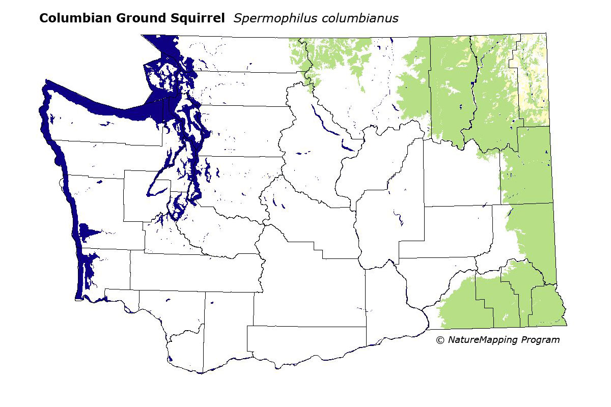
GAP Analysis Predicted Distribution Map
Columbian Ground Squirrel (Spermophilus columbianus)
Species Code: SPCO
|
Legend:
 = Core Habitat = Core Habitat
 = Marginal Habitat = Marginal Habitat
Breeding Range Map
The green area shows the predicted habitats for breeding only. The habitats were
identified using 1991 satellite imagery, other datasets and experts throughout the state, as part of the Washington Gap Analysis
Project.
Click to enlarge distribution map
Map with historical museum records
|
Metadata
(Data about data or how the map was made)
Occurs from lowlands to alpine zones in grasslands, pastures, uncultivated
fields, fence row corridors between cultivated fields, the small steep rocky
patches that are found on the sides of loess slopes in the Palouse, dense mid-elevation
forests, openings in the Hudsonian zone, and wet meadows and grasslands above
tree line. Also found in the easternmost steppe, the Blue Mountains, the northeastern
hills, and northeast Cascades.
Core zones east of the Okanogan Valley included the eastern steppe zones (the
Palouse, the Blue Mountain Steppe, Canyon Grasslands, Bunchgrass/Fescue, and
Big Sage/Fescue) and all forest zones of the Blue Mountains and northeastern
Washington except for the Interior Western Hemlock and Interior Redcedar, which
were peripheral. In the Northeast Cascades, Alpine/Parkland and Subalpine Fir
were core. Good habitats in core forested zones below Alpine/Parkland were
low density development, agriculture, non-forested, and open forest.
Translated from the Washington Gap Analysis Mammal Volume by Dave Lester
Webpage designed by Dave Lester