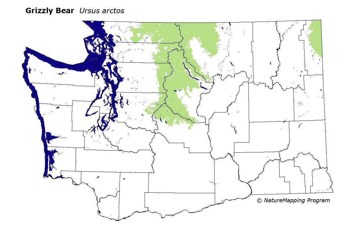
GAP Analysis Predicted Distribution Map
Grizzly Bear (Ursus arctos)
Species Code: URAR
|
Legend:
 = Core Habitat = Core Habitat
 = Marginal Habitat = Marginal Habitat
Breeding Range Map
The green area shows the predicted habitats for breeding only. The habitats were
identified using 1991 satellite imagery, other datasets and experts throughout the state, as part of the Washington Gap Analysis
Project.
Click to enlarge distribution map
Map with historical museum records
|
Metadata
(Data about data or how the map was made)
Grizzlies exist as identifiable populations in two areas of Washington, the extreme northeast around the Selkirk Mountains,
and in the North Cascade ecosystem. Actual sightings in the state are sporadic and rare with 21 reliable records found between
1964 and 1991. They are not believed to exist in sufficient numbers to maintain a viable population.
Range was limited to the most remote areas of the Cascades north of Snoqualmie Pass on highway I-90, and the extreme northeast
corner of the state. All zones within their range are core, with water/wetlands, non-forested, and all forested types being
good habitat. Most of the state was once part of the core range of Grizzlies and the habitat remains suitable in the absence of people.
Translated from the Washington Gap Analysis Mammal Volume by Dave Lester
Webpage designed by Dave Lester