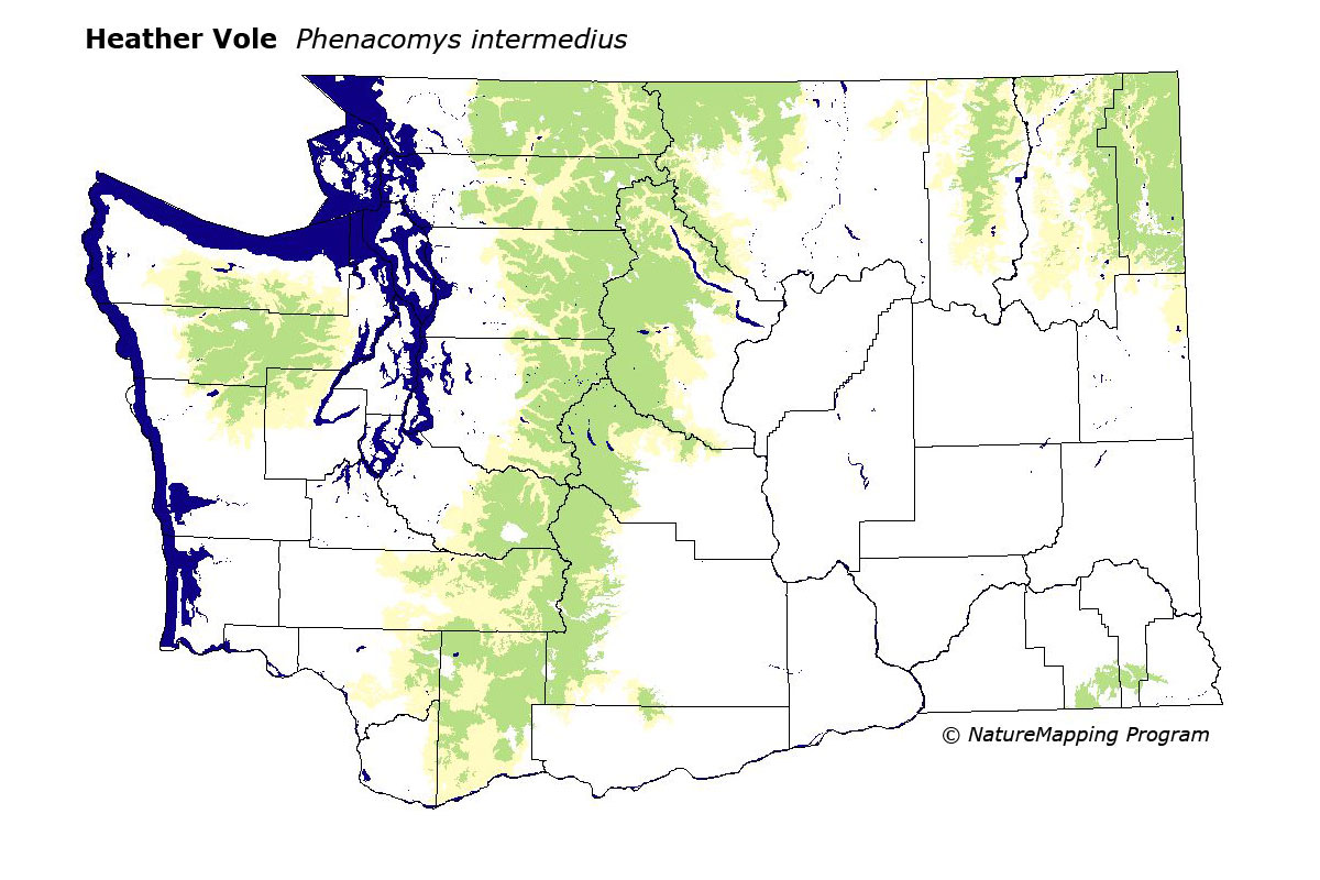
GAP Analysis Predicted Distribution Map
Heather Vole (Phenacomys intermedius)
Species Code: PHIN
|
Legend:
 = Core Habitat = Core Habitat
 = Marginal Habitat = Marginal Habitat
Breeding Range Map
The green area shows the predicted habitats for breeding only. The habitats were
identified using 1991 satellite imagery, other datasets and experts throughout the state, as part of the Washington Gap Analysis
Project.
Click to enlarge distribution map
Map with historical museum records
|
Metadata
(Data about data or how the map was made)
The Heather Vole is most abundant in the Hudsonian (sub-alpine) forests, krummholz, and moist alpine meadows. Occurs
in smaller numbers through lower forests in wet situations or dry sites next to small streams. At all elevations it is
usually associated with low scattered evergreen shrubs or herbs. The lower elevation range limit varies with location
but the higher limit is the permanent snow line.
Generally speaking, core zones were Western Hemlock and above. In the Blue Mountains, Sub-alpine Fir and High Open Forest
were core. In all zones, water/wetlands, non-forested, and forest were good habitats.
Translated from the Washington Gap Analysis Mammal Volume by Dave Lester
Webpage designed by Dave Lester