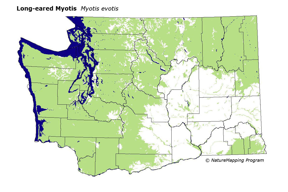
GAP Analysis Predicted Distribution Map
Long-eared Myotis (Myotis evotis)
Species Code: MYEV
|
Legend:
 = Core Habitat = Core Habitat
 = Marginal Habitat = Marginal Habitat
Breeding Range Map
The green area shows the predicted habitats for breeding only. The habitats were
identified using 1991 satellite imagery, other datasets and experts throughout the state, as part of the Washington Gap Analysis
Project.
Click to enlarge distribution map
Map with historical museum records
|
Metadata
(Data about data or how the map was made)
The Long-eared Myotis is generally distributed throughout Washington but is probably most common in east-side forests.
This is the most abundant bat in Lodgepole Pine forests in Washington. It occurs in humid coastal forests to semi-arid short-grass
prairie, but is probably limited to water courses in arid regions. It roosts in a variety of places including trees, buildings,
and caves. It feeds on both airborne insects and by gleaning.
All forest and steppe zones were core. In forested zones, all habitats were good except bare ground and mid- to high-density
development. In steppe zones, water/wetlands were good. In both forested and steppe zones, low-density development was adequate.
Translated from the Washington Gap Analysis Mammal Volume by Dave Lester
Webpage designed by Dave Lester