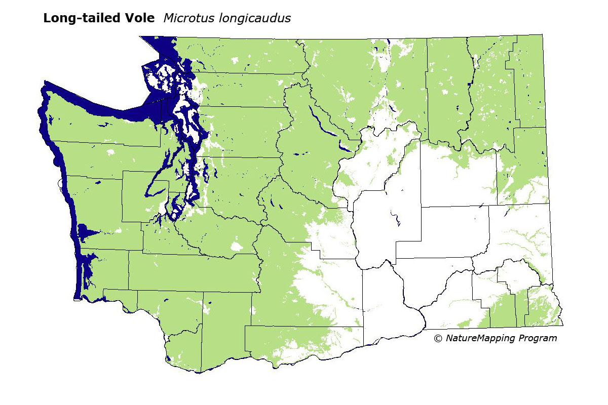
GAP Analysis Predicted Distribution Map
Long-tailed Vole (Microtus longicaudus)
Species Code: MILO
|
Legend:
 = Core Habitat = Core Habitat
 = Marginal Habitat = Marginal Habitat
Breeding Range Map
The green area shows the predicted habitats for breeding only. The habitats were
identified using 1991 satellite imagery, other datasets and experts throughout the state, as part of the Washington Gap Analysis
Project.
Click to enlarge distribution map
Map with historical museum records
|
Metadata
(Data about data or how the map was made)
Found in a wide variety of habitats, from sea level to krummholz at timberline, throughout the state except in the hottest,
driest part of the Columbia Basin. Present in all forest types, brush, marshes, meadows, rock slides, areas where forest and meadows or grasslands overlap, clearcuts, and forest burns. It is absent from the alpine zone above krummholz. Much more common near water in all vegetation zones. Found in meadows and grass lands in the western part of Washington but largely excluded from them in the eastern part of the state.
All zones where is occurs considered core area. Good habitats in most forested zones were pasture, water/wetlands
(except estuarine mudflats), and all non-forested and forested cover. Low density development was adequate habitat in all
zones. In steppe zones, only water/wetland was good habitat.
Translated from the Washington Gap Analysis Mammal Volume by Dave Lester
Webpage designed by Dave Lester