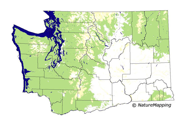
GAP Analysis Predicted Distribution Map
Mink (Mustela vison)
Species Code: MUVI
|
Legend:
 = Core Habitat = Core Habitat
 = Marginal Habitat = Marginal Habitat
Breeding Range Map
The green area shows the predicted habitats for breeding only. The habitats were
identified using 1991 satellite imagery, other datasets and experts throughout the state, as part of the Washington Gap Analysis
Project.
Click to enlarge distribution map
Map with historical museum records
|
Metadata
(Data about data or how the map was made)
Minks are common along most streams, rivers, lakes, ditches, coastal shoreline and bays, in swamps and marshes, and in the
surrounding forests and meadows of these wetland habitats from sea level up to the alpine zones. They are found in the
Columbia Basin more tightly restricted to waterways because of the drier conditions.
It is found in all zones except Alpine/Parkland. All zones except Steppe, Mountain Hemlock, and Sub-alpine Fir were core.
Good habitat in all zones in its range were water/wetlands, including estuaries and beaches.
The Mink, like the River Otter, is closely associated with water, but the Mink can use smaller rivers and wetlands.
Translated from the Washington Gap Analysis Mammal Volume by Dave Lester
Webpage designed by Dave Lester

 = Core Habitat
 = Marginal Habitat