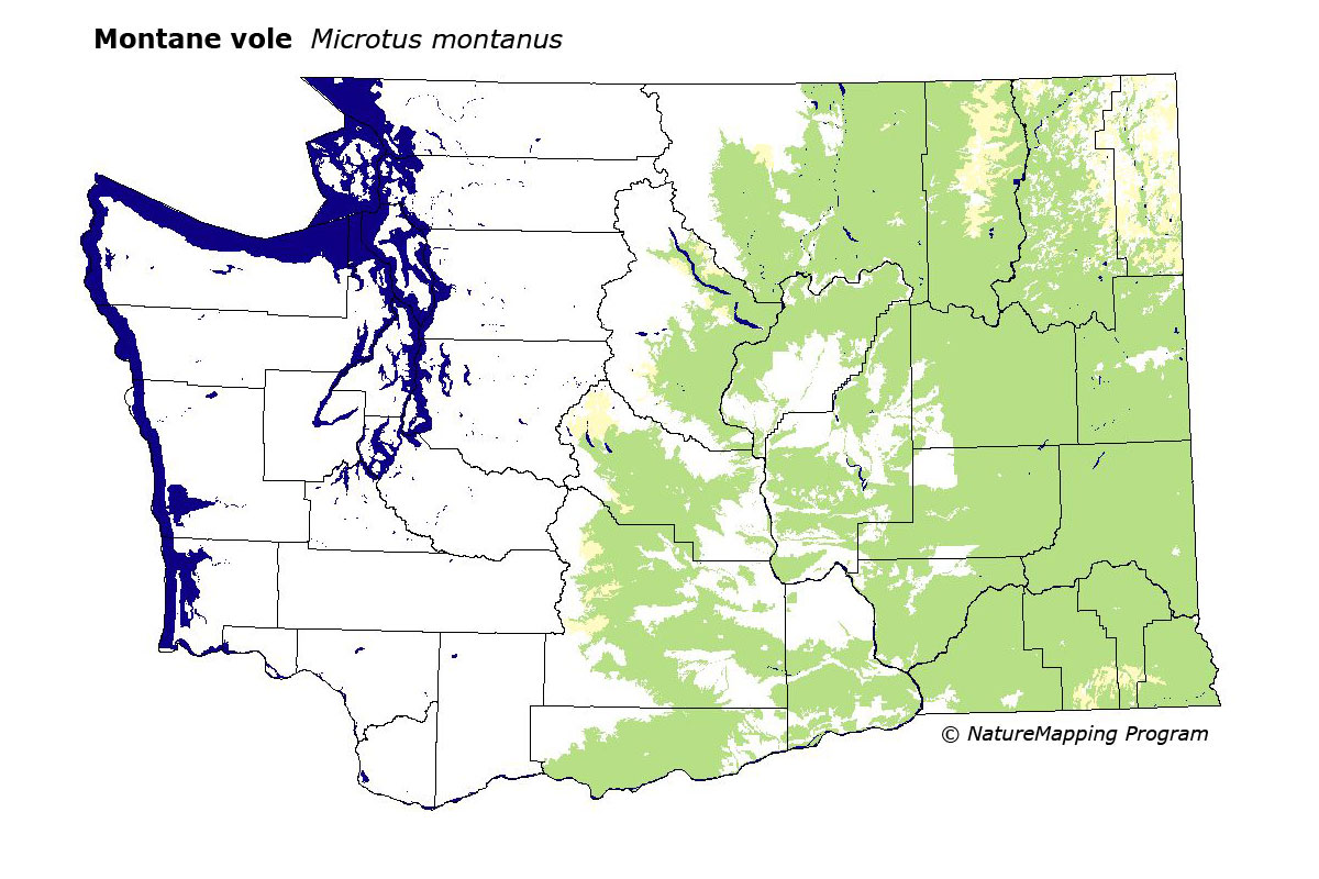
GAP Analysis Predicted Distribution Map
Montane Vole (Microtus montanus)
Species Code: MIMO
|
Legend:
 = Core Habitat = Core Habitat
 = Marginal Habitat = Marginal Habitat
Breeding Range Map
The green area shows the predicted habitats for breeding only. The habitats were
identified using 1991 satellite imagery, other datasets and experts throughout the state, as part of the Washington Gap Analysis
Project.
Click to enlarge distribution map
Map with historical museum records
|
Metadata
(Data about data or how the map was made)
Found east of the Cascade crest, mainly in grasslands, meadows, and marshes below timberline and at the borders of
cultivated wheat fields. In the sagebrush of the Columbia Basin, it is limited to riparian vegetation bordering streams,
rivers, ponds, and springs; on vegetated islands in the Columbia River, and moist meadows and marshes. Not found in open
dry sagebrush. May be found up to 4000 feet elevation.
Core zones included all steppe zones and the dry to medium dry east side forest zones (Oak, Ponderosa Pine, Interior
Douglas-fir, Grand Fir). Good habitats in all steppe zones included water/wetlands, irrigated fields, and forests. In the
forested zones, water/wetlands, non-forested, agriculture, hardwood and mixed forest, and open conifer were good habitats.
Translated from the Washington Gap Analysis Mammal Volume by Dave Lester
Webpage designed by Dave Lester