Home | About Us | Maps | Animal Facts
GAP Analysis Predicted Distribution Map
Home | About Us | Maps | Animal Facts
Species Code: ALAL
|
Habitat
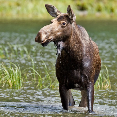
Moose, in Washington, are mostly limited to the northeast corner and the northeast Cascades, but are expanding their range and numbers. A few show up occasionally near Bellingham on the west side. In the Northeast Cascades, they are found along major water courses, primarily in Okanogan County. They can be found in coniferous and hardwood, closed canopy forest near stream bottoms, lakes and other wet areas. Must also have access to clear-cuts, burns, seed tree cuts, and other openings dominated by saplings and brush. If cover is available, may be found near alpine lakes.
Core zones are Interior Western Hemlock, Interior Redcedar, Interior Douglas-fir, Grand fir and Sub-alpine Fir. In all but the Interior Douglas-fir zone, all habitats are good except bare ground, developed areas, and agriculture. In the drier forest zones, water/wetlands are good habitat. Moose are dependent on readily available water.
Moose have been rapidly expanding their range in Washington and they are likely to be more widespread than indicated by the maps. Because they are large mobile animals, needed water may be available to them from most forest stands.
Translated from the Washington Gap Analysis Mammal Volume by Dave Lester
Design by Tim Knight; Photo: Nature Pics

 = Core Habitat
 = Marginal Habitat