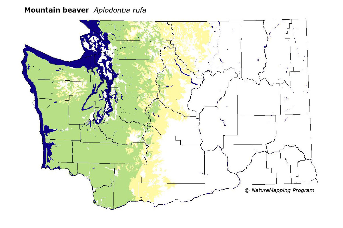
GAP Analysis Predicted Distribution Map
Mountain Beaver (Aplodontia rufa)
Species Code: APRU
|
Legend:
 = Core Habitat = Core Habitat
 = Marginal Habitat = Marginal Habitat
Breeding Range Map
The green area shows the predicted habitats for breeding only. The habitats were
identified using 1991 satellite imagery, other datasets and experts throughout the state, as part of the Washington Gap Analysis
Project.
Click to enlarge distribution map
Map with historical museum records
|
Metadata
(Data about data or how the map was made)
Requires deep soil for burrowing, dense thickets of vegetation, and very moist situations, often near streams or springs.
Occurs in forest and brush and more abundant in hardwood forest than coniferous. Does well in cut-over and second growth
forest and is a significant pest in gardens and forest plantations where it eats conifer seedlings. Found from sea-level
to treeline, but not above. More abundant at lower elevations and far more common west of the Cascade crest than east.
Core zones were all zones west of the Cascades below Mountain Hemlock. In all zones, low density development, fresh water/wetlands,
hardwood forest, and mixed forest were good habitats. It prefers habitats with lush vegetation.
Translated from the Washington Gap Analysis Mammal Volume by Dave Lester
Webpage designed by Dave Lester