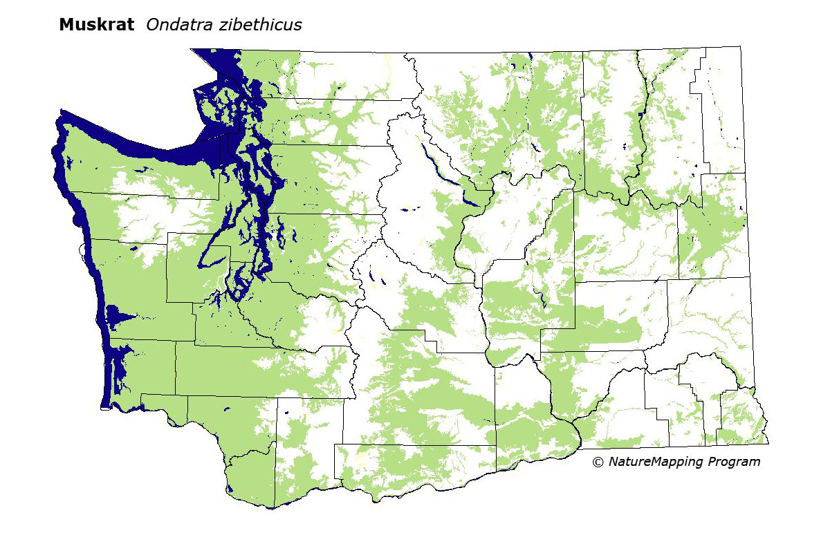
GAP Analysis Predicted Distribution Map
Muskrat (Ondatra zibethicus)
Species Code: ONZI
|
Legend:
 = Core Habitat = Core Habitat
 = Marginal Habitat = Marginal Habitat
Breeding Range Map
The green area shows the predicted habitats for breeding only. The habitats were
identified using 1991 satellite imagery, other datasets and experts throughout the state, as part of the Washington Gap Analysis
Project.
Click to enlarge distribution map
Map with historical museum records
|
Metadata
(Data about data or how the map was made)
Muskrats do best in still or slow-moving water, such as ponds, lakes, marshes, sloughs, and slow-moving rivers and
streams; may also be found along faster streams and rivers. They have been reported in salt marshes along the coast
and occasionally in tide pools. Muskrats have been reported in every Washington county except Franklin.
Zones up to and including Western Hemlock on the west side and Ponderosa Pine on the east side were core. In the
forested zones, water/wetlands were good habitat, and all other habitats except bare ground and high density development,
were suitable where wet microhabitats are found.
Translated from the Washington Gap Analysis Mammal Volume by Dave Lester
Webpage designed by Dave Lester