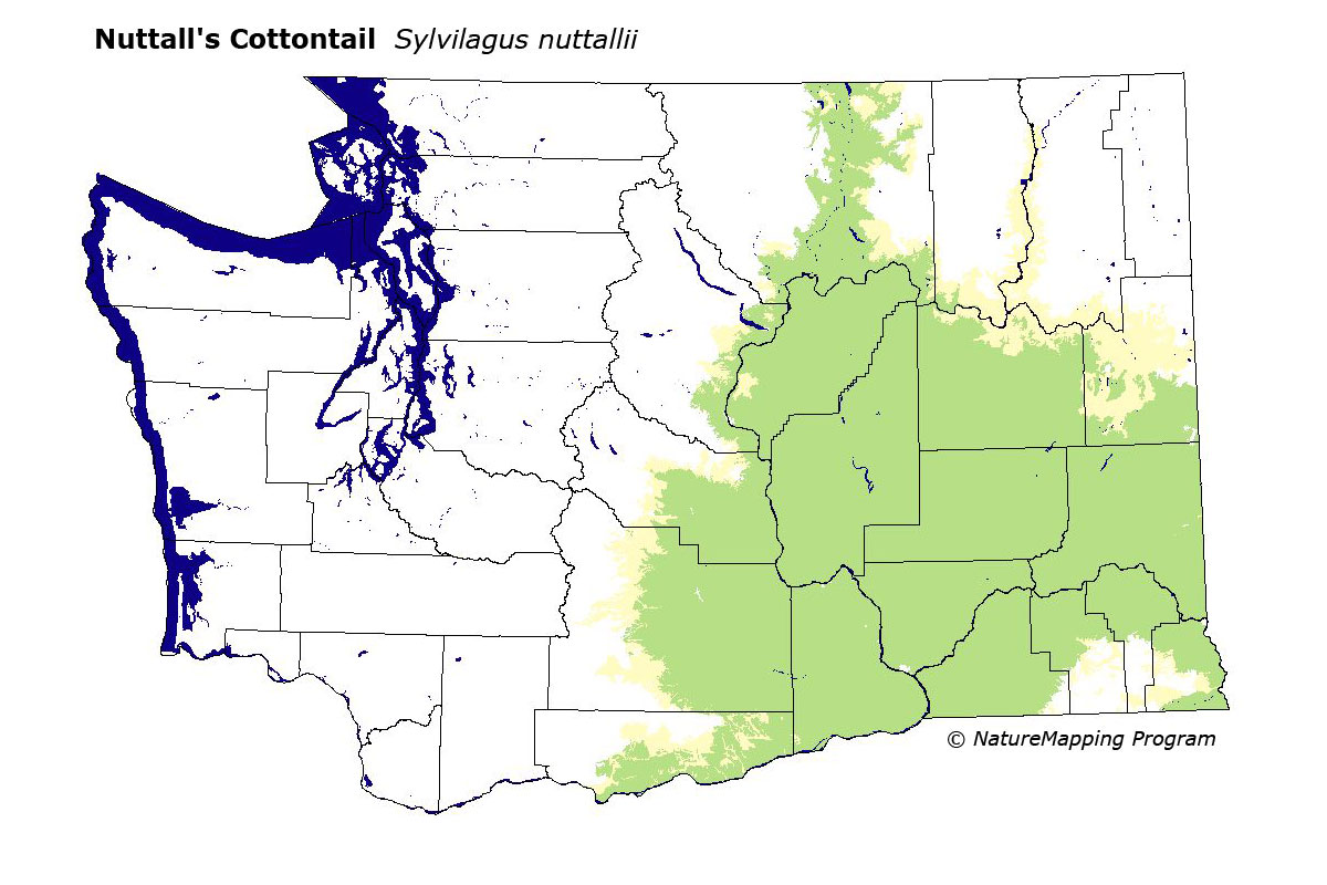
GAP Analysis Predicted Distribution Map
Nuttall's Cottontail (Sylvilagus nuttallii)
Species Code: SYNU
|
Legend:
 = Core Habitat = Core Habitat
 = Marginal Habitat = Marginal Habitat
Breeding Range Map
The green area shows the predicted habitats for breeding only. The habitats were
identified using 1991 satellite imagery, other datasets and experts throughout the state, as part of the Washington Gap Analysis
Project.
Click to enlarge distribution map
Map with historical museum records
|
Metadata
(Data about data or how the map was made)
Occurs primarily in the Upper Sonoran life zone in the Columbia Basin. Found in brushy and other types of habitat providing low cover, including sagebrush, riparian thickets, rock outcrops, gullies of rocks and/or brush, even if surrounded by open cultivated fields; abandoned buildings; and old car and farm machinery dumps. Probably found in every township in the Basin except the Methow Valley, where there are no records. Also found along the lower forest edges in open Ponderosa Pine at the edges of the Basin.
In the Basin and surrounding zones, all steppe zones were core areas, Oak and Ponderosa Pine were peripheral. Good habitats in the steppe zones included water/wetlands, low density development, non-forested and forested.
Translated from the Washington Gap Analysis Mammal Volume by Dave Lester
Webpage designed by Dave Lester