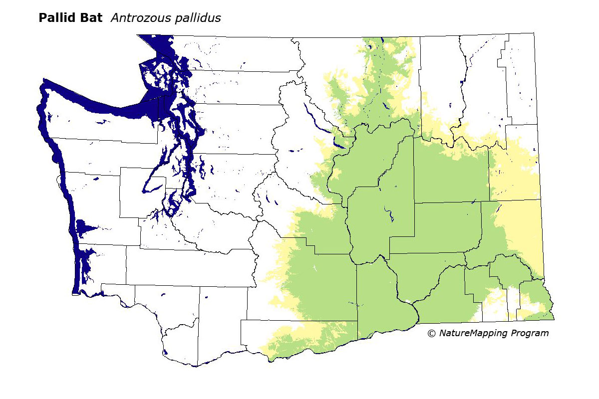
GAP Analysis Predicted Distribution Map
Pallid Bat (Antrozous pallidus)
Species Code: ANPA
|
Legend:
 = Core Habitat = Core Habitat
 = Marginal Habitat = Marginal Habitat
Breeding Range Map
The green area shows the predicted habitats for breeding only. The habitats were
identified using 1991 satellite imagery, other datasets and experts throughout the state, as part of the Washington Gap Analysis
Project.
Click to enlarge distribution map
Map with historical museum records
|
Metadata
(Data about data or how the map was made)
This bat is associated with river canyons and cliffs in steppe or desert, barely entering arid forests. It roosts primarily in narrow crevices of rock cliffs, but is also found in tree cavities, buildings, caves, mine adits, and crevices in caves. The Pallid Bat catches most of its prey by gleaning it from the ground or from foliage, but occasionally it catches insects in the air. Beetles tend to be a major component of its diet.
In the Columbia Basin and at the edges of the surrounding regions, all steppe zones were core except the Palouse; the Palouse, Ponderosa Pine and Oak zones where they are adjacent to steppe zones were peripheral. Non-forest, bare ground (usually basalt cliffs), and water/wetlands (which are usually associated with cliffs in the Basin) were good habitat. Open forest, agriculture, and low density development were adequate.
Translated from the Washington Gap Analysis Mammal Volume by Dave Lester
Webpage designed by Dave Lester