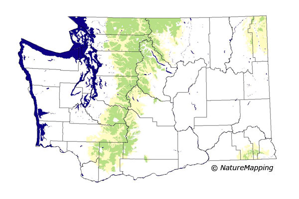
GAP Analysis Predicted Distribution Map
Richardson's Vole (Microtus richardsoni)
Also known as a Water Vole
Species Code: MIRI
|
Legend:
 = Core Habitat = Core Habitat
 = Marginal Habitat = Marginal Habitat
Breeding Range Map
The green area shows the predicted habitats for breeding only. The habitats were
identified using 1991 satellite imagery, other datasets and experts throughout the state, as part of the Washington Gap Analysis
Project.
Click to enlarge distribution map
Map with historical museum records
|
Metadata
(Data about data or how the map was made)
Found mostly in alpine and subalpine zones, seldom more than five feet from, clear cold streams through wet meadows, in marshes and bogs, and beside small ponds bordered by wet meadows or willows. On the east slope of the Cascades rarely below 4000 feet. In the Blue Mountains, around permanent springs and small cold springs between 5000 and 6000 feet.
Core zones were Alpine/Parkland, Subalpine Fir, Mountain Hemlock, and Silver Fir zones. Water/wetlands were good habitat, and forested and non-forested zones were suitable contingent on the existence of small bogs and lakes within them.
Translated from the Washington Gap Analysis Mammal Volume by Dave Lester
Webpage designed by Dave Lester

 = Core Habitat
 = Marginal Habitat