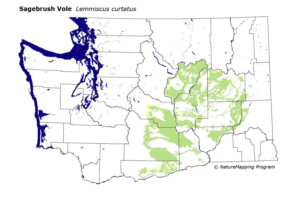
GAP Analysis Predicted Distribution Map
Sagebrush Vole (Lemmiscus curtatus)
Also known as (Lagurus curtatus)
Species Code: LACU
|
Legend:
 = Core Habitat = Core Habitat
 = Marginal Habitat = Marginal Habitat
Breeding Range Map
The green area shows the predicted habitats for breeding only. The habitats were
identified using 1991 satellite imagery, other datasets and experts throughout the state, as part of the Washington Gap Analysis
Project.
Click to enlarge distribution map
Map with historical museum records
|
Metadata
(Data about data or how the map was made)
Found in scattered sagebrush, generally less than three feet tall, and sparsely grassed, on dry loose soil between 900 and 3600
feet elevation. Not found in moist grassland or dense grass, or in the lower, drier and hotter areas of the Basin.
Core zones for habitat included steppe zones except the Canyon Grasslands, the Palouse, and the Grande Ronde Valley. Good habitats
were grassland and shrub savanna.
Translated from the Washington Gap Analysis Mammal Volume by Dave Lester
Webpage designed by Dave Lester