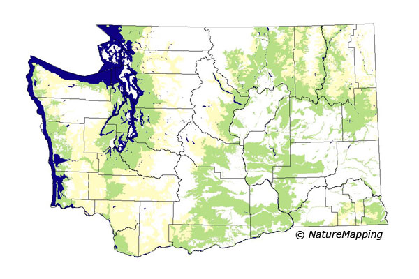
GAP Analysis Predicted Distribution Map
Striped Skunk (Mephitis mephitis)
Species Code: MEMEP
|
Legend:
 = Core Habitat = Core Habitat
 = Marginal Habitat = Marginal Habitat
Breeding Range Map
The green area shows the predicted habitats for breeding only. The habitats were
identified using 1991 satellite imagery, other datasets and experts throughout the state, as part of the Washington Gap Analysis
Project.
Click to enlarge distribution map
Map with historical museum records
|
Metadata
(Data about data or how the map was made)
The Striped Skunk is found in lowlands throughout Washington, preferring relatively open country such as logged lands,
old fields, open woods, brushy grassland, forest edges, riparian corridors, and agricultural areas. Wanders onto beaches at
low tide eating stranded animals. Found up to about 2000 feet on the west side of the state. Not known from any of the islands.
Core zones include all low elevation forest zones and the steppe zones. Good habitat in forested zones are low- and medium-density
development, agriculture, water/wetlands, and hardwood forest. The steppe zones are similar except that non-forested and non-irrigated
agriculture are excluded and all forest (usually along a river in steppe zones) is good habitat.
Translated from the Washington Gap Analysis Mammal Volume by Dave Lester
Webpage designed by Dave Lester

 = Core Habitat
 = Marginal Habitat