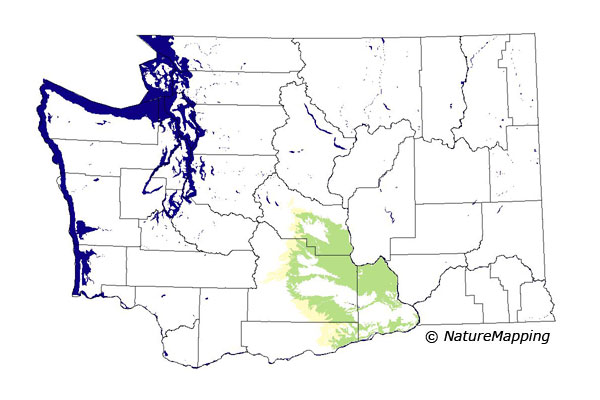
GAP Analysis Predicted Distribution Map
Townsend's Ground Squirrel (Spermophilus townsendii)
Species Code: SPTO
|
Legend:
 = Core Habitat = Core Habitat
 = Marginal Habitat = Marginal Habitat
Breeding Range Map
The green area shows the predicted habitats for breeding only. The habitats were
identified using 1991 satellite imagery, other datasets and experts throughout the state, as part of the Washington Gap Analysis
Project.
Click to enlarge distribution map
Map with historical museum records
|
Metadata
(Data about data or how the map was made)
Usually found in open sagebrush-grass habitat, but also enters pastures and abandoned fields. Occurs in high densities
along banks of canals, around springs, and adjacent to irrigated fields. Prefers sandy soil for digging. On the Hanford Nuclear
Reservation site found at all elevations from the Columbia River up to 3600 feet. Most abundant in sagebrush above 2000 feet
in the Basin.
Core area was the Central Arid Steppe zone with all non-forested habitat good. Not really associated with forested zones
but may occur in large patches of sagebrush at the lower edges of Oak and Ponderosa Pine zones.
Translated from the Washington Gap Analysis Mammal Volume by Dave Lester
Webpage designed by Dave Lester

 = Core Habitat
 = Marginal Habitat