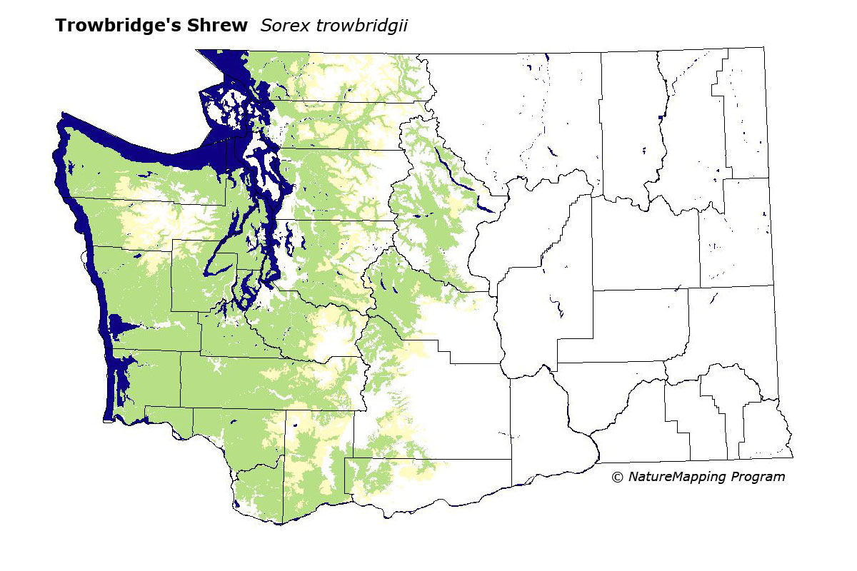
GAP Analysis Predicted Distribution Map
Trowbridge's Shrew (Sorex trowbridgii)
Species Code: SOTRO
|
Legend:
 = Core Habitat = Core Habitat
 = Marginal Habitat = Marginal Habitat
Breeding Range Map
The green area shows the predicted habitats for breeding only. The habitats were
identified using 1991 satellite imagery, other datasets and experts throughout the state, as part of the Washington Gap Analysis
Project.
Click to enlarge distribution map
Map with historical museum records
|
Metadata
(Data about data or how the map was made)
In western Washington to the lower east slopes of the Cascades, but not known from the northeastern Cascades, found mostly
in dry to mesic forest floors from sea level through the Canadian zone and occasionally in the Hudsonian. Highest elevations
found in Cascades 5600 feet and Olympics 4850. Most records are from below 3000 feet.
Range included all regions in the west part of the state, excluding the Northeast Cascades. Core zones were all mid- to low-elevation
forested zones within its range limits except for the driest forested zones. All Forests were good habitats except open forest in
the driest forest zones. In mesic and wet forest zones, cuts and burns were adequate in the earliest seral stages and good in later,
shrubby stages.
Translated from the Washington Gap Analysis Mammal Volume by Dave Lester
Webpage designed by Dave Lester