Home | About Us | Maps | Animal Facts
GAP Analysis Predicted Distribution Map
Home | About Us | Maps | Animal Facts
Species Code: SCGRI
|
Habitat
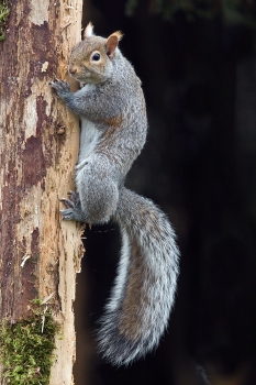
Occurs in many widely separated locations in Washington. In all cases, habitat is open forest of broadleaf, nut-bearing trees occurring in pure or mixed stands with conifers at low elevations. Garry Oaks are an important food source as is Western Hazel. The Garry Oaks occur along edges of west-side prairies, in Tacoma, Spanaway and Fort Lewis. On the east side, also associated with Garry Oaks in either pure stands or associated with Ponderosa Pines. Probably moved north of Yakima County when European settlers brought non-native nut-bearing trees.
Oak, Woodland/Prairie Mosaic, and Ponderosa Pine zones were core areas. Interior Douglas-fir and steppe zones, where adjacent to Ponderosa Pine or Oak zones, were peripheral. Good habitats in core zones include, water/wetlands, tree savanna, and hardwood and mixed forest. East of the Cascade Crest, low-density development was also good.
Their distribution east of the Cascades is probably less continuous than the model suggests because they are concentrated around oak groves and introduced nut-bearing trees.
Translated from the Washington Gap Analysis Mammal Volume by Dave Lester
Design by Tim Knight; Photo: Nature Pics

 = Core Habitat
 = Marginal Habitat