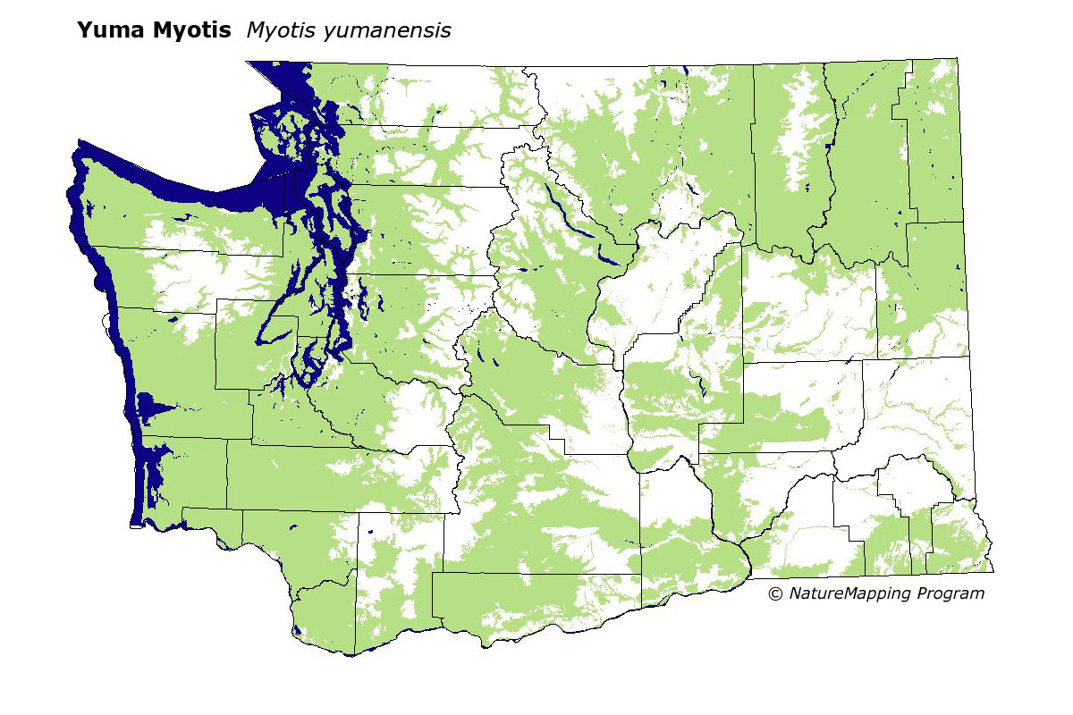
GAP Analysis Predicted Distribution Map
Yuma Myotis (Myotis yumanensis)
Species Code: MYYU
|
Legend:
 = Core Habitat = Core Habitat
 = Marginal Habitat = Marginal Habitat
Breeding Range Map
The green area shows the predicted habitats for breeding only. The habitats were
identified using 1991 satellite imagery, other datasets and experts throughout the state, as part of the Washington Gap Analysis
Project.
Click to enlarge distribution map
Map with historical museum records
|
Metadata
(Data about data or how the map was made)
This widespread bat is physically hard to distinguish from the Little Brown Myotis. It is a low-elevation bat that inhabits
coastal forests, Ponderosa Pine forests, Douglas-fir forests, and arid grasslands. It is more closely associated with water than
any other Washington bat.
Steppe and low to mid-elevation forest zones were core. In steppe zones, water/wetlands and irrigated fields were good habitat.
Forest zones, water/wetlands and irrigated fields were good habitat; all other habitats were contingently suitable except medium
to high-density development and bare ground.
Translated from the Washington Gap Analysis Mammal Volume by Dave Lester
Webpage designed by Dave Lester