 |
Metadata (Data about data or how the map was made)
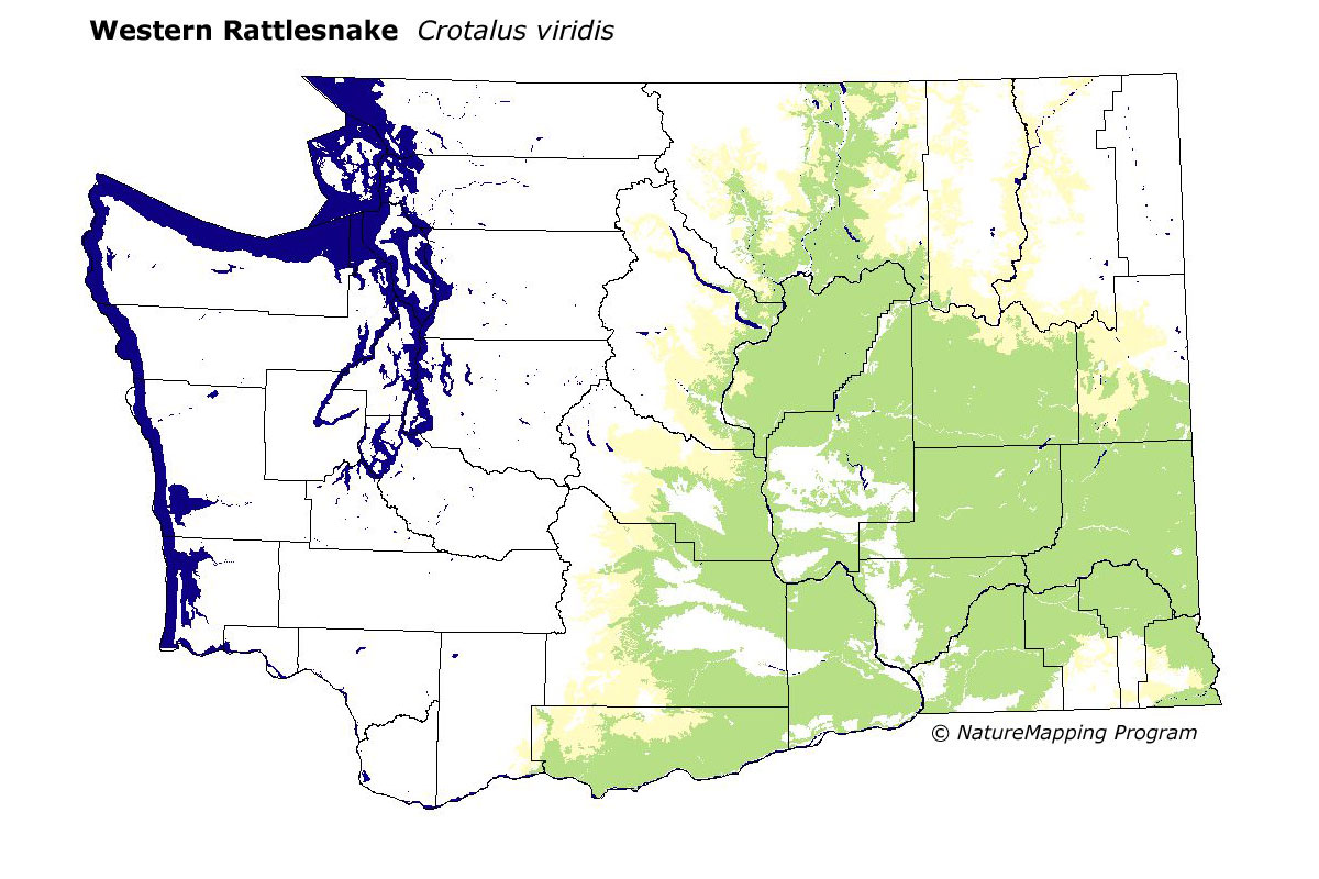
Legend:
 = Core Habitat
 = Marginal Habitat
Predicted Distribution
Reptiles do not migrate as some birds and mammals, so the colored areas depict
the predicted range for the Western Rattlesnake year-round. The habitats were
identified using 1991 satellite imagery, other datasets and experts throughout
the state, as part of the Washington Gap Analysis Project.
Predicted habitats include talus slopes, soil conservation reserves, grasslands, shrublands, shrub and tree savannas and all open-canopy forests. Non-irrigated agriculture was considered adequate. This means the long-term survival in this habitat is uncertain.
Other
maps & Information:
|
Distribution and Habitat Requirements
This species is distributed from central California northward through much of Oregon, eastern Washington, northcentral Idaho and in the Okanagan Valley in British Columbia. Hibernating
dens are commonly located in talus at the eupper edge of rock slides, where a layer of dirt and smaller rock covers the larger talus, and on southerly exposed grassy slopes.
Models
The East Central and Southeast Cascades, Northeast Corner, Okanogan highlands, Blue Mountains and the Columbia Basin ecoregions were selected.
Oak and all the steppe zones in the Columbia Basin were core. The Ponderosa Pine zone was marginal. The Interior Douglas-fir zone was also marginal in the East Central and Southeast Cascades.
Good habitats were talus slopes, soil conservation reserves, grasslands, shrublands, shrub and tree savannnas and all open-canopy hardwood, hardwood/conifer and conifer forests.
Non-irrigated agriculture was adequate.
Translated from the Washington Gap Analysis Amphibians and Reptiles Volume by Karen Dvornich
Webpage designed by Dave Lester.