Northwest Trek
Ohop Valley Creek Monitoring

Project Description and Goals:
The South Sound Salmon Enhancement Group along with the Nisqually Indian
Tribe, are working to restore the Ohop Valley Creek back to its
historical meandering pathway. This long-term project will ultimately
encompass the creek's path through the entire Valley down to the
Nisqually River. The original intent of the project was to restore
Salmon habitat, but has grown into an ecosystem restoration project that
will provide significant benefits to a large variety of wildlife.

Northwest Trek's role in the project is to coordinate volunteer citizen
scientists to collect data on the wildlife currently using the Valley.
Plans are to continue collecting data throughout the project and after
work is completed to show the changes in wildlife through the Valley.
Goals:
- Collect base-line wildlife data before the restoration work begins.
- Collect data during the restoration to document changes occurring during the physical changes to the Valley.
- Continue to monitor and collect data after the creek has been restored to determine which species are using the Valley after the restoration.
- Compare the data to determine if the species using the Valley has been altered by the restoration and if the project increased native species in the area.
Partners:
South Puget Sound Salmon Enhancement Group
Nisqually Indian Tribe
Nisqually Land Trust
US Fish and Wildlife Service
Pierce Conservation District
Natural Resources Conservation Service
The NatureMapping Program
Ohop Creek Wildlife Monitoring Fieldtrip
On our first field trip, some of the volunteers used NatureTracker
software on handheld units with built-in GPS to report their sightings.
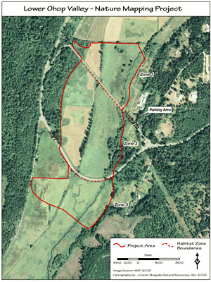
The map on the left shows data collected the first time the group went
out.
All teams are using NatureTracker units to collect data.
The map on the right shows data points from June 2008 - July 2009.
The next set of maps will be available in July, 2010 showing the restoration process.
Ohop species list (pdf)
Northwest Trek >>
| 
