Data Analysis
GIS
- Learning the concepts of GIS through Powerpoint and Excel
GIS is a powerful tool that demands consistency and an understanding of
spatial scales, as well as the connection between data tables and the pictures
on the screen.
If you want to create a map of a small area, such as a schoolyard, you may not need GIS. Powerpoint and Excel are programs that
can teach you the interconnectedness of GIS data layers. The following is a tutorial of how to develop a GIS layer and
relate data to the points or polygons.
View PowerPoint GIS Tutorial (ppt)
- ArcGIS Explorer Online
Directly from the internet, you can create your own maps and slideshows without the need for GIS software on your computer. Introduced July, 2010,
ArcGIS Explorer opens the world to K-12 students. Follow the instructions to view 3rd graders maps of
salmon migration and learn how to develop your own slide presentation.
You will need to download Silverlight (free from Microsoft).
- Community Explorer

Learn to use GIS to help evaluate the relationship between Spartina and Willapa Bay’s oyster beds.
Go to Community Explorer ...
For more information contact:
NatureMapping Support
natmap@uw.edu
|

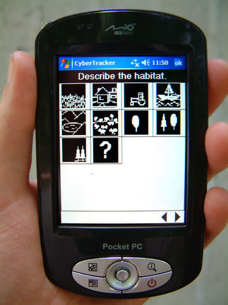 NatureTracker’s
icon driven data collection
screen on mobile handheld units, hotsync and see your data immediately on maps! Don't have a mobile unit? Use the desktop to mimic one and still
see your data on a map.
NatureTracker’s
icon driven data collection
screen on mobile handheld units, hotsync and see your data immediately on maps! Don't have a mobile unit? Use the desktop to mimic one and still
see your data on a map.